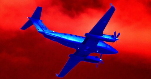
As the King Air flew north, they were high enough to see the lights of Ruidoso’s airport 31 miles to the southwest. To the pilots in the cockpit of the King Air, a visual approach must have seemed a tantalizing prospect. Why hang around waiting for ATC to give them vectors, why go through the mental acrobatics of trying to figure out where they were relative to the ILS beacon? All they had to do was fly toward the lights that they could clearly see through their windshield.
The King Air called Albuquerque Center and asked to “go visual.” The request was granted.
As they turned and descended toward Ruidoso’s lights, what the pilots couldn’t see was the 10,000-foot-high mass of the Capitan Mountains lying across their path. As they drew closer, the dark mass of rock appeared to rise up, swiping away the lights of the valley. This could have created "confusion and a loss of situational awareness,” Browne says. “When those lights go out, man, you know you are in big trouble.”
The pilots slowed their descent, even climbing a little, but it wasn’t enough. They kept flying straight toward the mountain. “When you are in that state of mind, you climb as high as you can,” Krentsa says. “And you circle. You stay in one place until you figure out where you are. You don’t just keep pressing forward, blindly.”
But that’s what the King Air pilots did. They flew straight into the rising slope and hit it at full speed. All four occupants died instantly.
The nature of warfare is changing profoundly, and quickly, as drones become cheaper, more numerous, and more deadly. Hard to spot, and hard to shoot down, they provide an effective way for smaller, less resourced nations to level the playing field against more powerful adversaries. Ukraine, nearly overwhelmed by Russia’s conventional warfare might at the beginning of 2022, has rapidly developed its drone force to gain what appears to be an upper hand in the conflict. And while the US achieved total air superiority over Iran after attacking the country this February, it has found itself helpless to stop Iran from using drones and missiles to effectively shut down traffic through the Strait of Hormuz.
To fight back, defenders can try to exploit a drone’s navigation. A cheap and simple way for drones to reach their targets is by GPS, which uses radio signals received from a constellation of satellites to calculate a position. When those signals are blocked, an enemy’s drones can be rendered blind. But the enemy, too, can take countermeasures. Drone and anti-drone technologies find themselves in an endless cat-and-mouse battle, each continuously trying to outdo the other. Exercises like NAVFEST offer a way for the US military to stay on top of the game.
Civilian GPS has become collateral damage, and air travel most of all. Since 2023, planes flying over large swaths of the Middle East, the Black Sea, and the Baltic Sea regions have endured waves of GPS jamming. Airlines have learned to adapt, but a price is still being paid. GPS was a major boost for airline safety, and while removing it may not instantly cause planes to fall from the sky, it removes a layer of protection from passengers and crew. Add in other stressors—a dark night, an inexperienced crew, a lack of proficiency in the backup technology—and the sum total is enough to yield disaster.
“There is no question that increased levels of GPS jamming and spoofing around the world pose a safety risk for commercial aviation. When alarms go off routinely in the cockpit, and when pilots learn to disregard key readings from their instruments because the readings can’t be trusted, we’re a long way from normal operation,” says Todd Humphreys, a professor of aerospace engineering at the University of Texas at Austin who has been a leading researcher into GPS disruption. “Air travel is still very safe, but it may be stuck for the next five years or more in a mild-and-increasing risk situation as we confront ever more GPS interference within the very-slow-to-adapt aviation industry.”
For a few years, US aviation was spared the disruptions of anti-drone electronic warfare. Then it started to happen here, too. In March 2025, airliners flying into Ronald Reagan National Airport in Washington, DC, received spurious alarms from a collision-avoidance system, and several had to abort their landings. It later turned out that the Secret Service was testing electronic warfare equipment at the vice president’s residence. This year, two separate incidents in West Texas involving US Army and CBP drone operations led to airspace closures and the disruption of commercial flights.
The aviation industry has been slow to grapple with the proliferation of counter-drone measures and their potential effects on flight safety. Airlines and other commercial operators are still heavily reliant on GPS for navigation, and other crucial technologies, like collision avoidance, are also vulnerable. “The harder problem with drones isn’t defeating them. It’s doing it without creating a system that negatively impacts civil aviation,” says Kris Brost, general manager of Robin Radar Systems, a drone defense company. “Counter-drone technology has to be surgical, not a sledgehammer, because the airspace we’re trying to protect is the same airspace the economy runs on.”
Living in a world with drones of both the friendly and unfriendly variety is going to take a lot of adjusting. Historically, major changes in aviation take place only after crashes that kill a large number of people. But a sufficiently motivating catastrophe may not be far off.
On July 7, a 737 freighter, operated by a tiny Pakistani cargo airline called K2 Airways, took off in the late afternoon from Sharjah in the United Arab Emirates and flew east toward Karachi with a five-person crew. Its route took it just south of the Strait of Hormuz, an area that had been experiencing intense GPS jamming due to the US-Iran conflict. Later, after nightfall, the flight crew called Karachi air traffic control and reported a “navigational system issue,” according to the Pakistan Civil Aviation Authority. In the three minutes that followed, the plane dove 5,000 feet, climbed 6,000 feet, and then plunged 36,000 feet into the ocean in a near-vertical dive, killing everyone aboard. It’s too early to know what caused the crash. But it won’t be any surprise if the electronic warfare made another pilot fly into darkness.
Update: 8/5/2026, 8:05 PM EDT: WIRED has updated the article to cite NTSB’s preliminary report.


Pt 2/2
As the King Air flew north, they were high enough to see the lights of Ruidoso’s airport 31 miles to the southwest. To the pilots in the cockpit of the King Air, a visual approach must have seemed a tantalizing prospect. Why hang around waiting for ATC to give them vectors, why go through the mental acrobatics of trying to figure out where they were relative to the ILS beacon? All they had to do was fly toward the lights that they could clearly see through their windshield.
The King Air called Albuquerque Center and asked to “go visual.” The request was granted.
As they turned and descended toward Ruidoso’s lights, what the pilots couldn’t see was the 10,000-foot-high mass of the Capitan Mountains lying across their path. As they drew closer, the dark mass of rock appeared to rise up, swiping away the lights of the valley. This could have created "confusion and a loss of situational awareness,” Browne says. “When those lights go out, man, you know you are in big trouble.”
The pilots slowed their descent, even climbing a little, but it wasn’t enough. They kept flying straight toward the mountain. “When you are in that state of mind, you climb as high as you can,” Krentsa says. “And you circle. You stay in one place until you figure out where you are. You don’t just keep pressing forward, blindly.”
But that’s what the King Air pilots did. They flew straight into the rising slope and hit it at full speed. All four occupants died instantly.
The nature of warfare is changing profoundly, and quickly, as drones become cheaper, more numerous, and more deadly. Hard to spot, and hard to shoot down, they provide an effective way for smaller, less resourced nations to level the playing field against more powerful adversaries. Ukraine, nearly overwhelmed by Russia’s conventional warfare might at the beginning of 2022, has rapidly developed its drone force to gain what appears to be an upper hand in the conflict. And while the US achieved total air superiority over Iran after attacking the country this February, it has found itself helpless to stop Iran from using drones and missiles to effectively shut down traffic through the Strait of Hormuz.
To fight back, defenders can try to exploit a drone’s navigation. A cheap and simple way for drones to reach their targets is by GPS, which uses radio signals received from a constellation of satellites to calculate a position. When those signals are blocked, an enemy’s drones can be rendered blind. But the enemy, too, can take countermeasures. Drone and anti-drone technologies find themselves in an endless cat-and-mouse battle, each continuously trying to outdo the other. Exercises like NAVFEST offer a way for the US military to stay on top of the game.
Civilian GPS has become collateral damage, and air travel most of all. Since 2023, planes flying over large swaths of the Middle East, the Black Sea, and the Baltic Sea regions have endured waves of GPS jamming. Airlines have learned to adapt, but a price is still being paid. GPS was a major boost for airline safety, and while removing it may not instantly cause planes to fall from the sky, it removes a layer of protection from passengers and crew. Add in other stressors—a dark night, an inexperienced crew, a lack of proficiency in the backup technology—and the sum total is enough to yield disaster.
“There is no question that increased levels of GPS jamming and spoofing around the world pose a safety risk for commercial aviation. When alarms go off routinely in the cockpit, and when pilots learn to disregard key readings from their instruments because the readings can’t be trusted, we’re a long way from normal operation,” says Todd Humphreys, a professor of aerospace engineering at the University of Texas at Austin who has been a leading researcher into GPS disruption. “Air travel is still very safe, but it may be stuck for the next five years or more in a mild-and-increasing risk situation as we confront ever more GPS interference within the very-slow-to-adapt aviation industry.”
For a few years, US aviation was spared the disruptions of anti-drone electronic warfare. Then it started to happen here, too. In March 2025, airliners flying into Ronald Reagan National Airport in Washington, DC, received spurious alarms from a collision-avoidance system, and several had to abort their landings. It later turned out that the Secret Service was testing electronic warfare equipment at the vice president’s residence. This year, two separate incidents in West Texas involving US Army and CBP drone operations led to airspace closures and the disruption of commercial flights.
The aviation industry has been slow to grapple with the proliferation of counter-drone measures and their potential effects on flight safety. Airlines and other commercial operators are still heavily reliant on GPS for navigation, and other crucial technologies, like collision avoidance, are also vulnerable. “The harder problem with drones isn’t defeating them. It’s doing it without creating a system that negatively impacts civil aviation,” says Kris Brost, general manager of Robin Radar Systems, a drone defense company. “Counter-drone technology has to be surgical, not a sledgehammer, because the airspace we’re trying to protect is the same airspace the economy runs on.”
Living in a world with drones of both the friendly and unfriendly variety is going to take a lot of adjusting. Historically, major changes in aviation take place only after crashes that kill a large number of people. But a sufficiently motivating catastrophe may not be far off.
On July 7, a 737 freighter, operated by a tiny Pakistani cargo airline called K2 Airways, took off in the late afternoon from Sharjah in the United Arab Emirates and flew east toward Karachi with a five-person crew. Its route took it just south of the Strait of Hormuz, an area that had been experiencing intense GPS jamming due to the US-Iran conflict. Later, after nightfall, the flight crew called Karachi air traffic control and reported a “navigational system issue,” according to the Pakistan Civil Aviation Authority. In the three minutes that followed, the plane dove 5,000 feet, climbed 6,000 feet, and then plunged 36,000 feet into the ocean in a near-vertical dive, killing everyone aboard. It’s too early to know what caused the crash. But it won’t be any surprise if the electronic warfare made another pilot fly into darkness.
Update: 8/5/2026, 8:05 PM EDT: WIRED has updated the article to cite NTSB’s preliminary report.