
3·
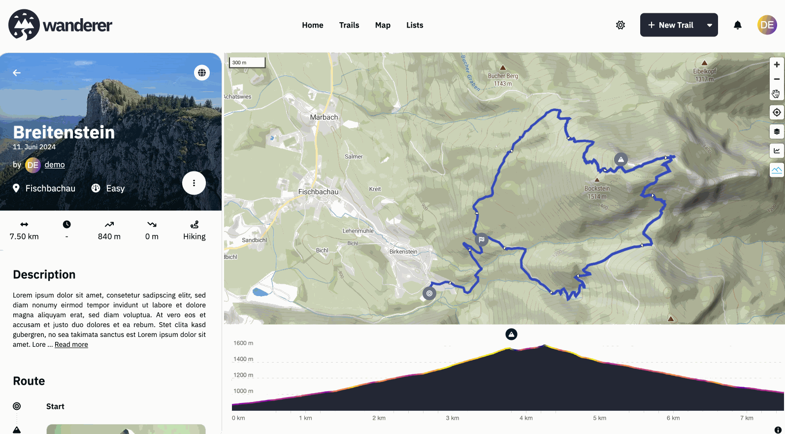
7 days ago- There is a mountain symbol on the map. Press it to activate the terrain. Drag the compass needle to tilt the map
- Thanks, fixed,
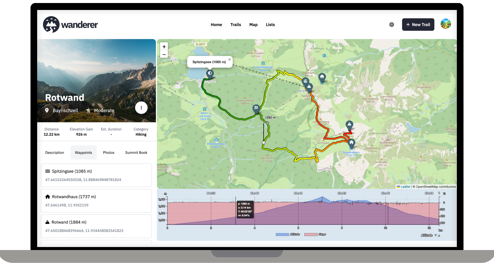
- A public trail is visible to everyone, including non-registered users. A shared trail is only visible (or editable) for the users you share the trail with
- If you add a summit log to a trail it is considered “completed”
- Can you provide a full error stack trace, please?
Have a look at the demo site. Everything is set up there already. I personally use the generous free tier of MapTiler.